
Датотека:Territorial losses of Germany.jpg
Originalna datoteka (1.100 × 938 piksela, veličina datoteke: 235 kB, MIME tip: image/jpeg)
| Ovo je datoteka sa Vikimedijine ostave. Informacije sa njene stranice sa opisom prikazane su ispod. Vikimedijina ostava je skladište slobodno licenciralnih multimedijalnih datoteka. I Vi možete da pomognete. |
Opis izmene
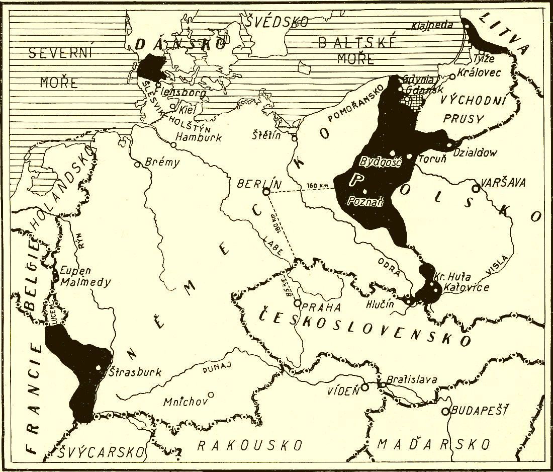
| Opis | Map of territorial losses (the areas in black) of Germany after the 1919 Treaty of Versailles. The descriptions are in Czech. |
| Datum | |
| Izvor | Czech geographical magazine Zeměpisný měsíčník Širým světem, ročník XIV. |
| Autor | Nepoznat |
Licenciranje
|
Ова слика је верна дигитализација оригиналног дводимензионалног уметничког дела. Ово уметничко дело је у јавном власништву из следећих разлога:
Званичан став Задужбине Викимедије је да „верне дигитализације дводимензионалних уметничких дела која су у јавном власништву, су такође у јавном власништву”. Стога су фотографске репродукције у јавном власништву у Сједињеним Државама. Имајте на уму да зависно од државе у којој живите поновно коришћење овог садржаја можда забрањено или ограничено. За више информација погледајте Commons:Reuse of PD-Art photographs. {{PD-Art}} template without license parameter: please specify why the underlying work is public domain in both the source country and the United States
(Usage: {{PD-Art|1=|deathyear=''year of author's death''|country=''source country''}}, where parameter 1= can be PD-old-auto, PD-old-auto-expired, PD-old-auto-1996, PD-old-100 or similar. See Commons:Multi-license copyright tags for more information.) | ||||
Istorija datoteke
Kliknite na datum/vreme da biste videli tadašnju verziju datoteke.
| Datum/vreme | Minijatura | Dimenzije | Korisnik | Komentar | |
|---|---|---|---|---|---|
| trenutna | 23:17, 26. mart 2008. | | 1.100 × 938 (235 kB) | Geographus | {{Information |Description= Map of territorial losses (the areas in black) of Germany after the 1919 Treaty of Versailles. The descriptions are in Czech. |Source= Geographical magazine Zeměpisný měsíčník Širým světem, ročník XIV. |Date= 1937 | |
Upotreba datoteke
Sledeća stranica koristi ovu datoteku: